Ensuring flood safety, protecting the natural environment, and addressing waste management issues are key concerns highlighted by experts as Hanoi presses ahead with the implementation of the Red River urban zoning plan.
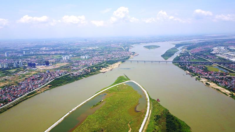
| Red River from above. Photo: Pham Hung/The Hanoi Times |
Dr. Architect Dao Ngoc Nghiem, Vice Chairman of the Vietnam Urban Planning and Development Association, suggested development planning for areas along the Red River has always been a priority for the city.
Through seven rounds of planning, Hanoi has made adjustments to harness the potential of the Red River. A significant milestone was achieved in 2022 when the city approved the 1/5,000-scale zoning plan for the Red River, covering the stretch from the Hong Ha Bridge to the Me So Bridge. This plan spans 11,000 hectares across 55 communes and wards within 13 districts, he noted.
Nghiem stressed, however, that it is critical to address the challenges of ensuring safe flood drainage as the plan is carried out.
“Given the unique characteristics of the river and the impact of climate change, comprehensive research across various fields, including security, national defense, regional connectivity, and science and technology, is imperative to adapt to changes in the river's flow, ensure the safety of the watercourse, and maintain the sustainability of construction projects,” said Nghiem.
Bui Cong Quang, a former senior lecturer at the Water Resources University, echoed these concerns, noting that the biggest "obstacle" to realizing the Red River planning has always been the regulations on flood prevention and dike safety. The Flood Prevention and Dike Planning for the Red River and Thai Binh River systems, approved by the Prime Minister in Decision No. 257/QD-TTg on February 18, 2016, stipulates that areas such as the mid-river sandbanks are not eligible for construction or even for research purposes.
Following the catastrophic flood of 1971, the Government introduced urgent measures to strengthen flood control in the Northern Delta, including building upstream reservoirs to regulate downstream floods and constructing flood-slowing works. By 1974, Hanoi's dike system was able to withstand a flood of 13.4 meters.
In recent years, several hydropower reservoirs have been constructed upstream on the Red River - Thai Binh River system, such as the Hoa Binh, Son La, Tuyen Quang, and Lai Chau reservoirs. These are critical flood control infrastructures in the lower reaches, ensuring the safety of Hanoi during floods, so that the flood recurrence interval in Son Tay, Hanoi's upland area, would be 500 years or less, and keeping the Red River's flood level in Hanoi below 13.4 meters.
"This level of safety is relatively high, meaning that flood drainage is no longer a pressing issue, especially with current technological advancements," said Quang.
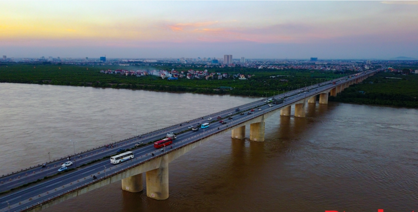
| Thanh Tri Bridge crossing the Red River. Photo: Huy Khanh/The Hanoi Times |
Protecting natural environment
Nguyen Truong Duy, Secretary-General of the Hanoi Mechanics Association, also emphasized that floods on the Red River are now controlled by "circuit breakers," such as the Son La, Hoa Binh, Lai Chau hydropower reservoirs, and the Day River dam. However, he expressed concern about the river during the dry season when water levels drop and the flow stagnates, leading to pollution and landscape degradation.
"The Ministry of Agriculture and Rural Development has proposed that the city consider building two temporary weirs on the Red River and Duong River during the dry season to retain water. Water levels of 3 to 5 meters would make the river mesmerizing and inviting for water travel," Duy suggested. He added that technological solutions could support the construction of suitable structures in areas prone to frequent or partial flooding.
Prominent experts in Hanoi are interested in the environmental impact assessment of the Red River urban zoning plan. Associate Professor Dr. Nguyen Duc Luong from the University of Civil Engineering pointed out that under the Environmental Protection Law, surface water sources must be strictly protected. The Red River is one such vital water source for the city.
"According to the draft of Hanoi Capital Planning, some water quality monitoring data from the Red River from 2016 to 2020 showed slight organic pollution. Therefore, when implementing development along the banks of the Red River and on its mid-river sandbanks, the primary focus should be on protecting the surface water quality," noted Luong.
The Red River urban zoning plan divides the river section flowing through Hanoi into three main zones. The first zone, from Hong Ha Bridge to Thang Long Bridge, will focus on developing ecological spaces and preserving natural areas. The second zone, from Thang Long Bridge to Thanh Tri Bridge, is planned as a multifunctional center with public facilities. The final zone, from Thanh Tri Bridge to Me So Bridge, will be developed for agricultural activities like vegetable farming and aquaculture.
"Each area will have specific environmental considerations of its own and related to others. In the central zone, urbanization, population growth, and economic development will increase domestic wastewater. The agricultural zone poses a risk of water pollution. Therefore, it's essential to implement solutions to effectively control waste sources, build centralized wastewater treatment systems, and manage solid waste sustainably," he emphasized.